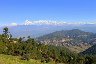
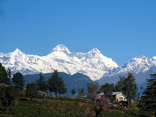
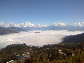
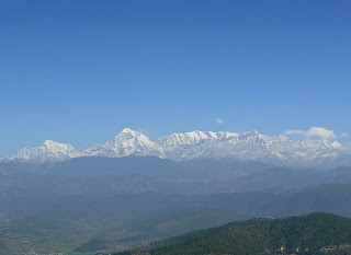
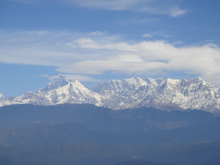
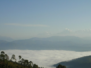
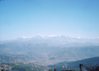
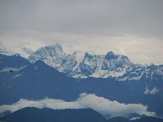
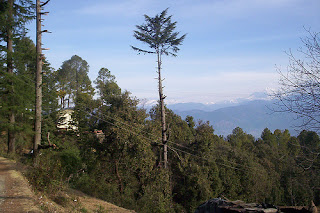
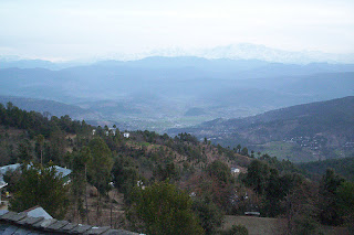
Kausani is a hill station situated in the Almora district of the Uttarakhand state of India. Kausani is a destination for Himalayan tourists. It is located 53 km North of Almora. The altitude of this place is about 1890 mts. This place offers a 350 km view of the Himalayan peaks like Trisul, Nanda Devi and Panchchuli. There are very few places in the Himalayas which can compare with the beauty of Kausani - a picturesque hill station famous for its scenic splendor and its spectacular 300 km-wide panoramic view of the Himalayas. Kausani lies on the atop the ridge amidst dense Pine trees overlooking Someshwar valley on one side and Garur and Baijnath Katyuri valley on the other on Almora-Bageshwar-Didihat Highway. Mahatma Gandhi called this place the 'Switzerland of India', due to similarity in landscape.
How to Reach Kausani
By Air: Pantnagar is the nearest airport form Kausani located 177 km away from Kausani. Private taxies or Uttarakhand state transport buses are easily available from here to reach Kausani.
By Rail: The nearest railway station from Kausani is Kathgodam located 142 km away from the Kausani.
By Road: Kausani has very well connectivity to the major cities of India by raod. Some important distances from Kausani are:
Delhi to Kausani - 418 km
Nainital to Kausani - 118 km
Almora to Kausani - 52 km
Best Time to Visit Kausani
April to June and September to November is the best season to visit Kausani. For couples December, January & February is the better option to visit Kausani as during these months they can enjoy snow fall.
Kausani Weather
Places to Visit in & arround Kausani
Trisul
Trisul is a group of three Himalayan mountain peaks of western Kumaun, with the highest (Trisul I) reaching 7120m. The three peaks resemble a trident - in Hindi/Sanskrit, Trishul, trident, is the weapon of Shiva. The Trishul group forms the southeast corner of the ring of peaks enclosing the Nanda Devi Sanctuary, about 15 kilometres (9 mi) west-southwest of Nanda Devi itself. The main peak, Trisul I, was the first peak over 7,000 m (22,970 ft) to have ever been climbed, in 1907.
The Trisul massif can be accessed via the following route:
Almora - Kausani - Garur- Gwaldam - Debal - Bagargad - Wan - Bedini Bugyal - Kelva Vinayak - Roopkund - Trisul.
Nanda Devi
Nanda Devi is the second highest mountain in India (excluding Pakistan occupied Kashmir) and the highest entirely within the country (Kangchenjunga being on the border of India and Nepal); owing to this geography it was the highest known mountain in the world until computations on Dhaulagiri by western surveyors in 1808. It was also the highest mountain in India before Sikkim joined the Indian Union. It is part of the Garhwal Himalayas, and is located in the state of Uttarakhand, between the Rishiganga valley on the west and the Goriganga valley on the east. Its name means Bliss-Giving Goddess. The peak is regarded as the patron-goddess of the Uttarakhand Himalaya.
Baijnath
Baijnath is a town in Kangra district of Himachal Pradesh. It is roughly fourteen kilometres from the town of Palampur. It is very famous all over the world as it is believed to be one of twelve jyotirlingas according to popular legends.
Baijnath is located at 32.05°N 76.65°E. It has an average elevation of 1,314 metres (4,311 feet). It is a small township in the Dhauladhar range of western Himalayas, 16 km from Palampur in the Kangra District of Himachal Pradesh.
The main attraction of Baijnath is an ancient temple of Shiva. Neighbouring towns are Palampur and Kangra.
Chaukori
Chaukori is a tiny hill station in the Pithoragarh district set among the lofty peaks, of the western Himalayan Range in the Kumaon Division of Uttarakhand, India. To the north is Tibet and to the south is Terai. The Mahakali River, running along its eastern boundary, forms the Indo-Nepal international border.
Chaukori's elevation is 2010 m with a spectacular view of the snowy peaks of peaks of Nanda Devi, and Nanda Kot. It is approximately 10 km from Berinag, another little hill station.
Berinag
Berinag, a tiny hill station, is located 10 km from Chaukori in the Pithoragarh district, the most eastern Himalayan district in the state of Uttarakhand , India. It is accessible by road. Closest prominent villages include Dhanoli, Bana, Bhattigaon, Banoli and Sangarh. A quite, beautiful and worthseeing place known for sight seeing of Himalaya peaks Such as Nandadevi and Panchachuli.
Berinag is located at 29.80°N 80.07°E. It has an average elevation of 1,740 metres (4,180 feet).
Gangolihat
Gangolihat is a small Himalayan hill town in the Pithoragarh district of Uttarakhand, India. It is tehsil and sub divisional headquarter of the district. Gangolihat is famous for its Shakti Peethas of Hat Kalika of goddess Kali. Nearby at 'Patal Bhubneshwar', underground caves are major tourist attraction. Also nearby are the tiny hill stations of Chaukori and Berinag. From Gangolihat Panchchuli peaks and Nanda Devi are clearly visible.
Patal Bhuvaneshwar
Patal Bhuvaneshwar, one of the most fascinating places of the Kumaon region, is a limestone cave temple 14 km from Gangolihat in the Pithoragarh district of Uttarakhand state in India. It is located in the village Bhubneshwar. Legend and folklore have it that this underground cave enshrines Lord Shiva and thirty three crore Gods. The cave is 160 m long and 90 feet deep from the point of entrance. Limestone rock formations have created various spectacular stalactite and stalagmite figures of various hues and forms. This cave has a narrow tunnel-like opening which leads to a number of caves. The cave is fully electrically illuminated. There is a folklore that the Pandava brothers passed their time here during banishment. It is built due to the flow of water. It cut the rocks in such a fascinating way that it looks like that any artist had made those entire statues within the cave & on its wall. It has some cave opening and it is believed that these opening will be close as the centuries pass on. The scientific fact is it still being developed due to crystallization of the minerals which are dissolved in the water. As per believe, some doors which are now closed were opened thousand of years back. It is yet not been fully explored. It is also believed that this cave is internally connected to the four abodes /seats (Char Dham).
Gwaldam
Gwaldam is a hill station, situated between the Garhwal and Kumaon. 30 km from Kausani.
Gwaldam is located at 30.02°N 79.57°E. It has an average elevation of 1,708 metres (5,604 feet).
Gwaldam is a small town itself, the main reason for its prosperity is a large SSB Training ground located within the center of the town.
The view of Nanda Devi from Gwaldam is beautiful especially of a morning or evening.
Pindari Glacier
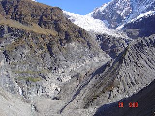
The Pindari Glacier is a glacier found in the upper reaches of the Kumaon Himalayas, to the southeast of Nanda Devi, Nanda Kot. The glacier flows to the south for a short distance of about 3km and gives rise to the Pindari river which meets Alakananda at Karnaprayag in the Garhwal district.
The trail to reach the glacier crosses the villages of Saung, Loharkhet, over the Dhakuri pass, onto Khati village (the last inhabhited village on the trail), Dwali, Phurkia and finally Zero Point, Pindar, the end of the trail. Though most of the trail is along the banks of the Pindari river you don't get to see the river till after Khati. As one approached the Khati village you can be confused by the sight of a river, that is not Pundari that is the Sundardunga flowing to meet the Pindari at Khati, its origin the Maiktoli Glacier.
The Pindari Glacier trail provides for a 90 km (56 mile) round-trip trek that most people find comfortable to complete in five days.
Kafni Glacier
The Kafni Glacier is located in the upper reaches of the Kumaon Himalayas, to the southeast of Nanda Devi. The glacier gives rise to the Kafni river, which is a tributary of the Pindar River. Pinder river is a tributary to Alaknanda River, which eventually is one one of the two headstreams of the Ganges. This is relatively small glacier but a popular trekking destinations along with Pindari Glacier.
Milam Glacier
Milam Glacier is a major glacier of the Kumaon Himalaya. It is located in the tehsil of Munsiyari, part of the Pithoragarh district of Uttarakhand, India, about 15 kilometres (9 mi) northeast of Nanda Devi. It ranges in elevation from about 5,500 metres (18,000 ft) to about 3,870 metres (12,700 ft) at its snout. It covers around 37 km2 (14 sq mi) and is 16 km (10 mi) long.
Milam Glacier is situated on the south facing slope of the main Himalayan range. It originates from the eastern slope of Trishuli and the southern slope of its eastern subsidiary Kohli. The subsidiary glaciers coming off the peaks of Hardeol, Mangraon (6,568 m), Deo Damla (6,637 m), and Sakram (6,254 m) on the eastern rim of the Nanda Devi Sanctuary flow into it from the west, while on the east it is fed by glaciers from Nanda Gond (6,315 m) and Nanda Pal (6,306 m). The glacier is the source of the Goriganga River. The village of Milam lies near the snout of the glacier; Munsiyari, further down the Goriganga valley, is the base for the trek to the glacier.
Hotels in Kausani
Hotel Pine Havens
Sun n Snow Inn
Himvadi Resort
Hotel Uttarakhand
The Misty Mountain Retreat
Krishna Mountview Resort
Suman Royal Resort
Chevron Eco Lodge
Kausani Best Inn
Sagar Hotel











No comments:
Post a Comment